In Part 1 of this tale had already made our way down the River Nene and across the Middle Level to the Great Ouse and the Old West River. Now it was time for us to head up the river to Bedford.
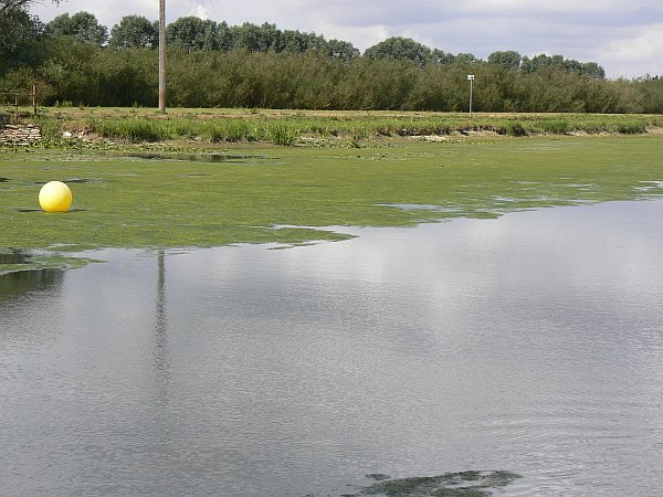
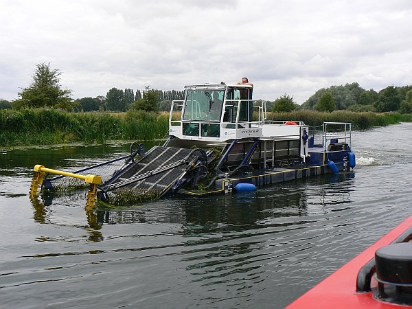
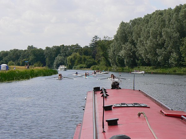
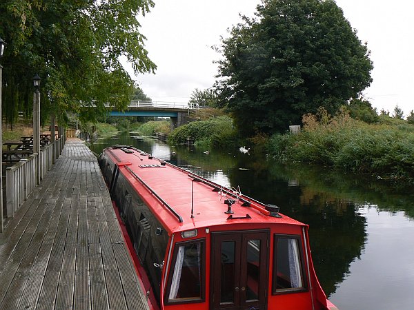
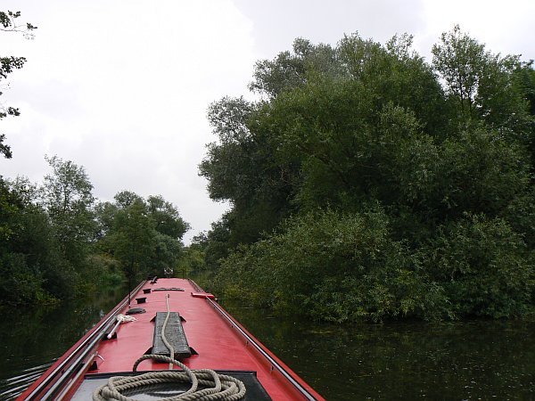
At the end of the Old West River is Earith, where the river is briefly again tidal. In 2004 when we had been here the river level had been several feet higher, but this time it was low enough to cause different problems; many boats were running aground in the shallows, and also there was a thick blanket of weed to either side of the centre channel..
|
|
|
|
|
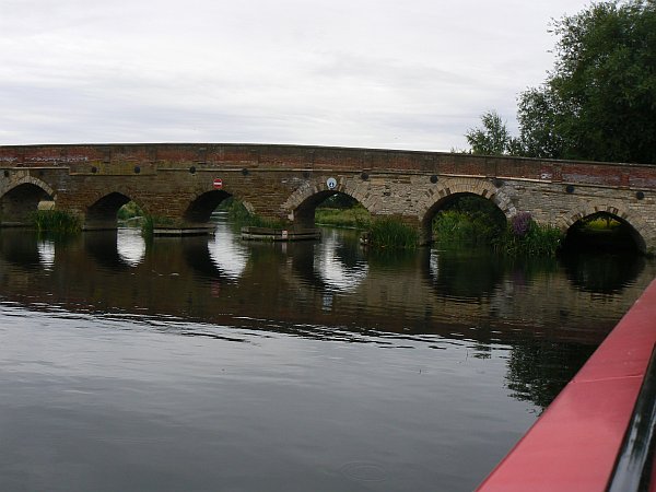
The river at Earith in 2004 |
The same stretch of river at Earith in 2010 was very shallow ... |
... and very full of weed ... |
... which the EA were fighting with purpose-made weedcutters |
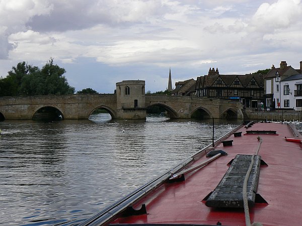
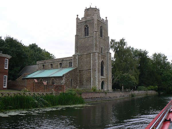
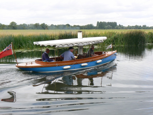
We stopped again at St Ives for a day. The bridge there, with its little chapel in the middle, is simply beautiful, with all the extra arches giving an indication of the way the river has always been prone to flooding. This time however there was no problem with the water level, which was just ideal. Then the next morning we headed up-river past the beautiful church of Hemingford Grey, where we were overtaken rapidly by a beautiful little steam launch whom we then caught up with as they waited in the next lock for us; like most of the locks on the Great Ouse the chamber has a lay-by inside so that it is wide enough to accommodate two boats with ease, even though the gates are often less than 14ft wide.. Shortly after that we stopped and chatted to another member of the Canal World Discussion Forum whose boat was also built by Stoke-on-Trent Boatbuilders, but a couple of years before ours. One of the best things about cruising without a time schedule, is that you can stop and chat to people whenever you like and for as long as you like.
 |
 |
 |
 |
The bridge at St Ives with its chapel in the middle |
The old arches of the bridge at St Ives |
Hemingford Grey |
Overtaken by a steam launch |
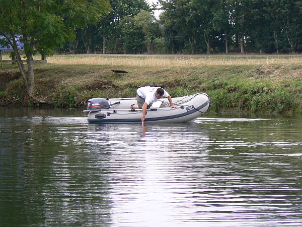
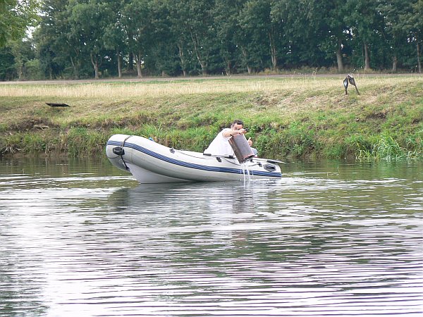
At Huntingdon we met up with a very nicely built (and rather large) cruiser, whose owner seemed to share our view of how boating should be done. He even offered to let us breast up outside him when we were looking for a mooring! This is most unusual, although I must say that we found everybody on the river to be very friendly this year. We were to meet up with him again further up the river, at Great Barford where he had lost his barbeque overboard; it was made of stainless steel so it could not be retrieved with a magnet, but luckily the water was so clear that he was able to find it and retrieve it from his dinghy by using a boathook, to a round of applause from the watchers ashore.
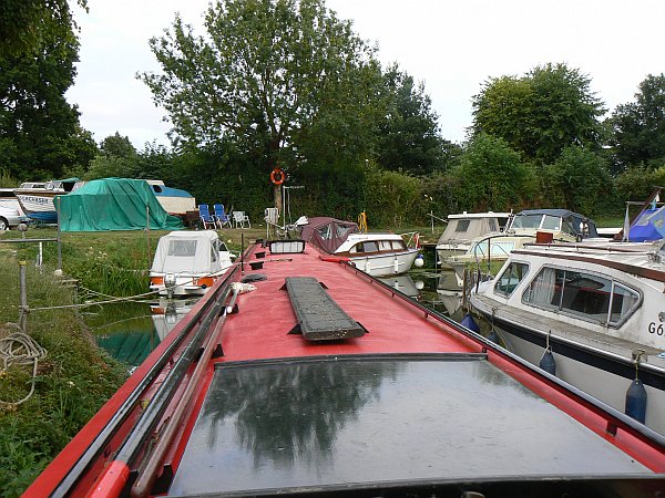
At St Neots they were holding a rowing regatta. As it was rather windy, the marshals advised us to follow the rowers along the course rather than to attempt the narrow navigation channel between the course and the bank. So as soon as the two boats had set off on their race we followed them; we could not keep up with them of course, but we did pass the finishing line in a creditable third place. We had been offered a mooring at the marina in the centre of St Neots, despite being somewhat larger than the boats around us, and we took full advantage of their kind offer as this meant we could easily explore the town before returning to the boat for a barbeque.
 |
 |
 |
 |
Waiting to join the rowing regatta at St Neots |
A tight fit for us in St Neots marina |
Looking for the lost barbeque ... |
... and finding it |
We were joined at Great Barford by a couple of friends who were keen to see Bedford from the river. Despite something of a hangover after a good evening with our friends from the cruiser - as well as another couple of friends from the Forum who had also joined us for the evening - we were up early to greet them and to make our way gently up the river. We had learned on our previous visit that with a long boat like ours it is best to ignore the signs on Great Barford bridge and to take the downstream arch when heading upstream, otherwise the current pushes the bows of the boat into the bushes before the stern has cleared the bridge, so that is what we did (much to our friends' surprise).
 |
 |
 |
 |
Great Barford bridge. The upstream arch leads straight into the bushes beyond |
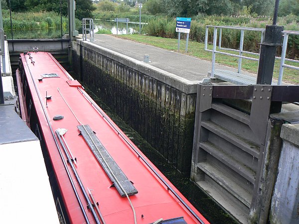
Bedford lock |
Testing the depth where we grounded just short of Kempston |
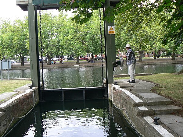
The unusual lock at Castle Mills has side paddles (slackers) for both filling and emptying |
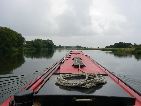
We had a lovely trip up the river, which was flowing very gently, and soon reached Bedford. We saw kingfishers everywhere, and easily passed under the Bedford bridges with a foot of clearance (unlike our tight squeeze in 2004). After a brief pause for lunch we were ready to attempt the last 3 miles up to Kempston. Several people had told us that we wouldn't make it, saying it was too shallow and weedy, but actually we had very few problems; the depth was fine (until Kempston itself) and the weed was no trouble as long as we stayed right in the middle of the river; our only difficulty was that a tree had fallen across the navigation channel at the small group of islands so we had to invent a rather more 'interesting' and twisty route between them.
When we were a hundred yards short of Kempston bridge we ran hard around on a bar of shale which ran across the entire width of the river. In 2004 the river had been in flood so we had crossed it without noticing, but this time it was obvious from soundings with our long shaft that we were not going to be able to cross it. Unfortunately this also meant that we were 50 yards short of the winding place, so we had to reverse for half a mile before we could turn around just below the large island. Happily we made our way back through Bedford, where we attracted a large crowd of spectators when passing through the lock, and made our way back to Great Barford for another night.
Retracing our steps, and stopping again to chat with various Forum members that we met on the way, we stopped for a night at Hemingford Grey whose church looked so pretty from the river. The village also looked very pretty as we walked through it, but the inside of the church was a disappointment as it was bland and soul-less. Maybe I'm doing them a disservice, but the use of presentation-suite software called "Easyworship" did not fill me with confidence. After that we saw the whole village differently, it seemed as if an ancient but prettified facade was designed to present a rose-tinted view of the entire place. We hurried on down the river, and along the Old West, until we passed the site of the old Fish and Duck at Pope's Corner; we turned towards Cambridge at that point and moored outside the wonderfully named "Five Miles From Anywhere, Why Hurry" pub. Unfortunately for Telford at this point we were breasted up outside two other narrowboats; he did not notice that the sterns were not completely level and missed his footing to fall in the river for the first time in his 10 years of life; actually I think he rather enjoyed his impromptu swim, as it was a nice hot afternoon, but he'd never admit it.
 |
 |
 |
An old hexagonal windmill which is now used as a private house |
Isleham lock on the Lark |
Isleham lock on the Lark |
 |
 |
 |
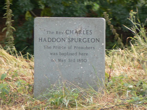
The Lark was widely used for baptism. This stone marks where Charles Spurgeon the "Prince of Preachers" was baptised in 1850 |
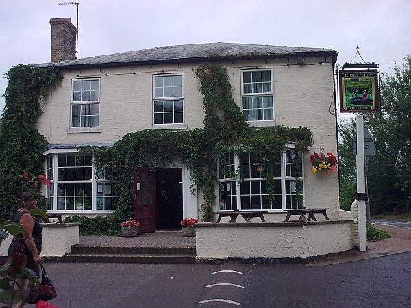
The excellent pub at Judes Ferry |
The pub's garden mooring at Judes Ferry |
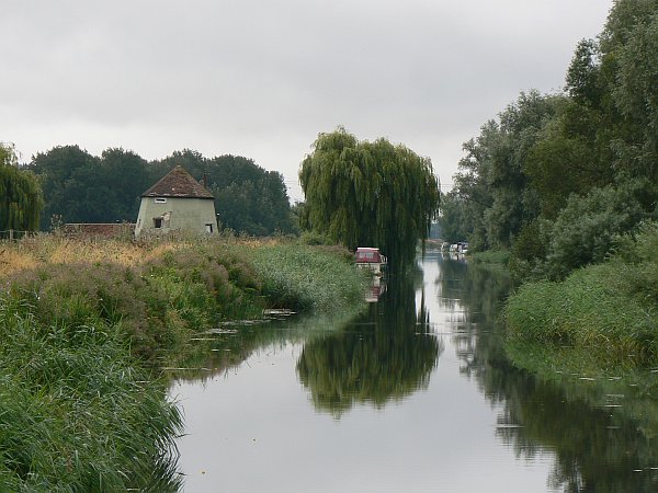
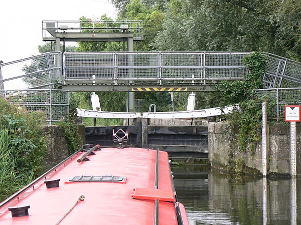
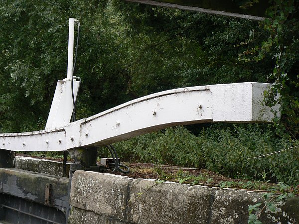
Now it was time to investigate a few tributaries. In 2004 we had explored only the first couple of miles of the Lark, reaching Prickwillow, before deciding that the river was too boring to be worth exploring any further. This time we pressed on past Prickwillow where the river was surprisingly full of people swimming, and indeed the next few miles are extremely boring, but then the navigation joins the original course of the river and it suddenly becomes magnificently beautiful. It was narrow and winding, with (as Sue on No Problem so eloquently remarked in her blog) kingfishers "dripping from the trees". The electrically-operated lock at Elsenham was really elegant with its sweeping curved balance beams, and the journey from there to the limit of navigation at Judes Ferry was as beautiful as any that we have found anywhere. The pub at Judes Ferry was simply marvellous, with plenty of room to wind and moor a full-length boat (despite what it says on Imray's maps).
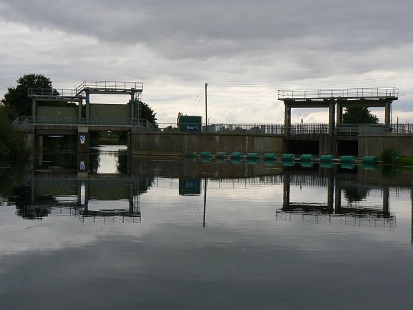
The next day we travelled up the Little Ouse, otherwise known as Brandon Creek, as far as Brandon Lock. This lock is only 42ft long so there was no way we could pass through it, but we did put the boat in it so that we could say we did our best. Luckily again contrary to the statement in Imray's map, there is plenty of room to wind below the lock. It was particularly interesting to study the aqueduct over the Relief Channel (the same relief Channel that we had navigated below Denver), where at times of flood the guillotine is closed to divert the river water away from the Ouse and down through another (opened) guillotine into the Relief Channel.
 |
 |
 |
 |
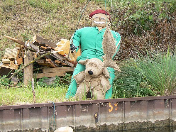
Even the scarecrows enjoy fishing in Brandon Creek |
This is as far as we can get into Brandon Lock |
The navigation is through the left-hand guillotine, over the aqueduct. At times of flood it is shut and the right-hand one is opened to let the water run into the Relief Channel |
Through the navigation channel's guillotine |
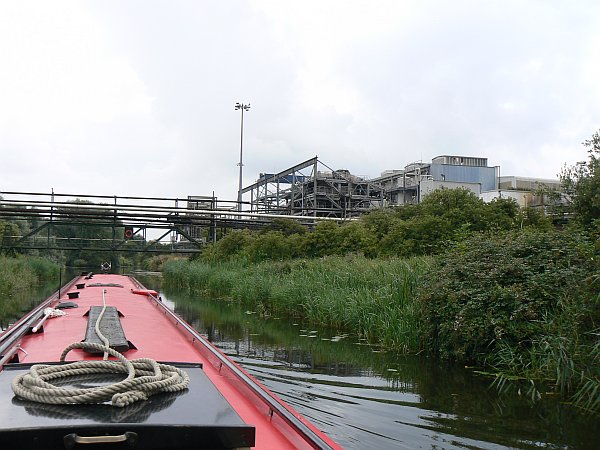
The following day we travelled up the beautiful River Wissey, our favourite of the Little Ouse tributaries. At times it is so narrow as to be barely passable, but at other times it widens into a huge lake. It passes through wonderful countryside, but also passes along the edge of the amazingly industrial sugar beet factory. This river was the first to give us any real problems with weed, which filled the river with a carpet of bright green slime that waited like a giant evil candy-floss to envelop the propeller and turn it into a useless football of vegetation. Also we had that day some torrential showers amongst the sunshine, heavy enough for me to adopt the strategy of aiming the boat towards the reeds and abandoning the tiller until the rain slackened.
At the end of the Wissey there is a giant caravan park, following which it is possible to wind, but unfortunately there is nowhere to moor unless you are a member of the Great Ouse Boating Association (which we are not). In fact there is nowhere else to moor along the whole length of the river apart from at Hilgay which is near the junction, so we returned to the Great Ouse and moored at the place where the Windmill pub has been demolished to allow the road bridge to be widened.
 |
 |
 |
 |
The River Wissey is extremely pretty ... |
... apart from the sugar beet factory which is a maze of industrial plumbing |
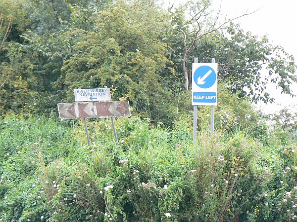
Various old and new sins point the way to the navigation channel |
The Wissey becomes a wide lake for a couple of miles |
Now it was time to return to the Fens, so we contacted the lock-keeper at Salters Lode to find out about the times of the tides. He advised us to arrive at Denver early in the morning so that we could come down with the last of the ebb, which would allow him to clear us through the lock out of the ay of the boats that were waiting to come through from Well Creek. We followed his advice but unfortunately the lock-keeper at Denver did not share his point of view, and the two of them had a lively discussion about it until the Denver lock keeper agreed to send us out straight away. Unfortunately by then it was almost low tide so there was very little depth of water and we came to a halt on the mud just next to the pontoon; the lock keeper had a solution however, and reopened the guillotine to flush us over the mud like a surf-rider. We quickly travelled down to Salters Lode, where again there was not enough depth to let us reach the lock, but here too the lock-keeper flushed some water down and with the engine at maximum revs we just made it up into the lock. The lock keeper's comment was "That was exciting, I wish I could have been on board for that!"
 |
 |
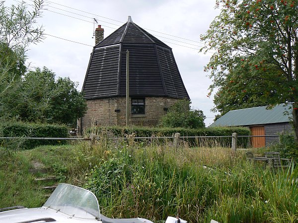
Another old hexagonal windmill now being used as a private house; this one is at Nordelph |
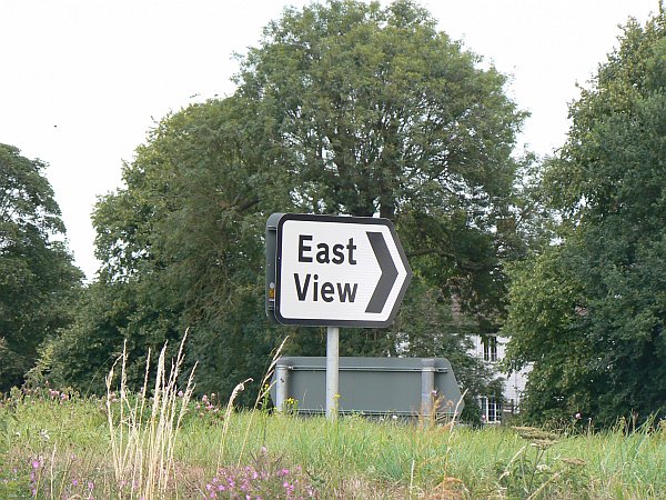
The signpost is very accurate, it does point towards an eastwards view. I wonder if the far sides of the other two road signs say "North View" and "South View" ? |
Feeling elated at our successful trip on the Great Ouse we decided to treat ourselves to a good meal, and stopped at the Crown Lodge Hotel at Outwell. They have a small mooring available, which is very good but rather difficult when you have two lively dogs as it leads directly out on to a busy main road. The pub was absolutely excellent, very friendly and helpful with superb beer and wonderful food; I'd definitely recommend it to anyone.
So finally we set out to explore some more of the Fens before making our back up the Nene and down to the Thames ...
All pictures on this site are © Allan Jones unless otherwise stated
![]()