After our earlier trips on the Thames this year, we were determined to get the best possible value from our Gold licence by revisiting the River Nene and the Great Ouse which we had last seen in 2004. On that occasion the rivers had been rather too full of water, so we were looking forward to seeing them under more normal conditions. Although the North-West of England was suffering from continuous rain, and at the same time canals such as the Leeds-Liverpool were closing because of water shortages, the weather in the south and east promised to be excellent for us.
We had just completed the main run of locks down the Northampton Arm, and were approaching the bridge under the M1 motorway, when we encountered a boat which had broken down. They had only set off from their home base at Weston Favell the previous day, so they had decided that a return to base was their best option. We did not let the fact that they were facing in the wrong direction put us off. We offered to tow them backwards to Northampton where they could wind and attempt to return to Weston Favell in our company. The canal was very weedy, and their boat had a square stern, so progress was very slow indeed but eventually we reached the river and they were able to make their own way to their home mooring because their engine would run OK as long as they kept it revving hard. We moored alongside them at their boat club and spent an enjoyable evening in their club house. We also gained one useful tip from them, that when crossing the Northampton Washlands in normal conditions there is absolutely no need to follow the shallow, narrow, weedy channel that is marked; as long as there is no hint of flooding (which can give rise to strong currents near the weirs) you can take the direct course across the lake, to the outside of the islands.
It was annoying to discover that the pump-out machine in Northampton had broken because, knowing that the machines on the Nene are free, we had arrived with a full tank so we had to go into Billing Aquadrome for a pump-out. It was good to see that the marina there has a new manager who now provides ALL the usual facilities for visiting boaters.
|
|
|
|
|
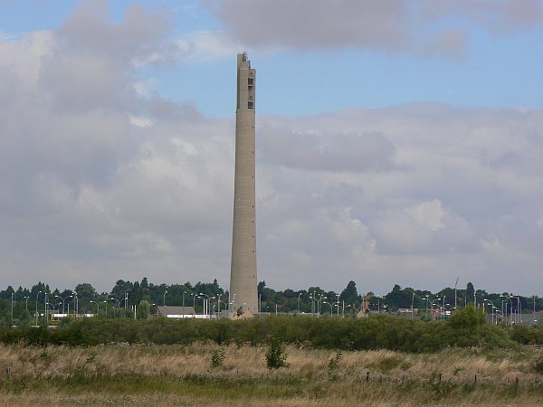
The "Northampton Lighthouse" (actually it's the old Otis lift testing tower) |
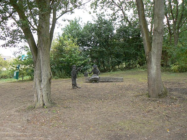
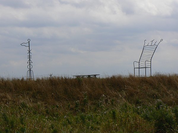
I liked this wire sculpture beside the Northampton Arm |
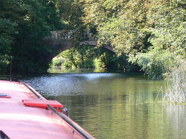
This beautiful bridge across the Nene at Lilford leads to ... |
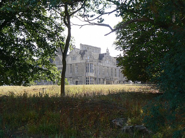
Lilford Hall, a magnificent Jacobean house which is still a private residence. |
We had a lovely peaceful trip down the Nene - apart from some gale-force winds which swept across the Fens at 55mph and made steering just a little difficult at times - stopping at Cogenhoe, Irthlingborough, Wadenhoe, Fotheringhay (where the farmer sold us some milk because we'd run out) and Wansford (where there is a new mooring pontoon beneath the Nene Valley Railway bridge), before making our way to Peterborough. Another boater had told us about the old Watergate moorings, directly outside Asda, where there is an almost-invisible gate in the railings which gives you an easy way to stop and get your supplies from the supermarket, so we were able to stock up before travelling on to the old Dog and Doublet moorings. The pub has closed but there is still a good visitor mooring above the lock, and we were met that evening by our daughter Vicki, with Paul and Lauren who came with us for the ride through Peterborough the next day.
And so we dropped back down to the Middle Level. On our way to March we met another member of the Canal World Discussion Forum, who dropped a mud-weight down so that the two boats could just stop where we were for a drink and a chat. I am now firmly converted back to the idea of using a mud-weight (I used them all the time on the Norfolk Broads but had never though of using them from a narrow boat) and have since bought one off eBay.
 |
 |
 |
 |
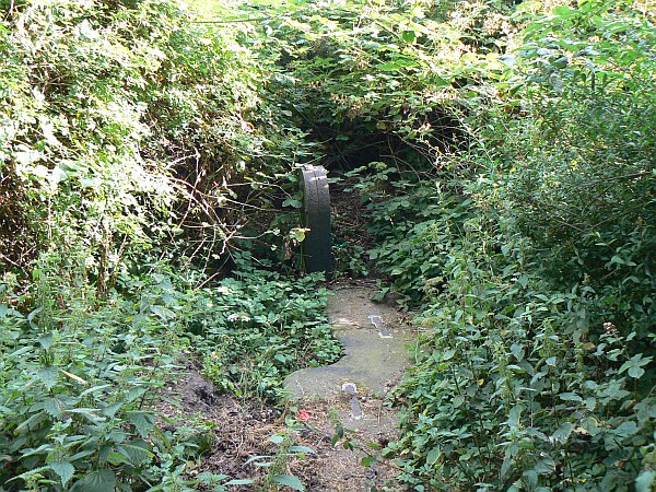
A disused lock on the Wisbech Canal |
Moored at Outwell |
Moored at Outwell |
"The last Eel Catcher" |
That night we moored at Outwell. Imray's guide warns that you need to be careful because the bend there is "More than 360 degrees"; I think the author needs a lesson in geometry because although such a bend is theoretically possible it would be very difficult and probably unique. There is however a bend of more than 180 degrees, where the creek meets the old Wisbech Canal, with a mooring on the outside which makes you a prime target for anyone who fails to make it round the corner!
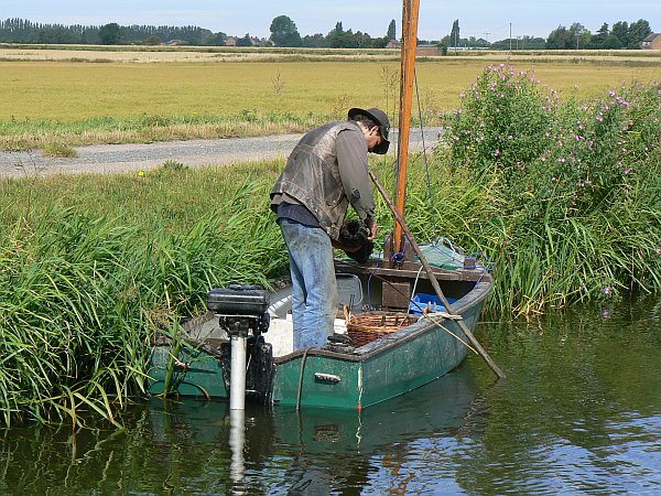
The next day we were due at Salters Lode for the 11:15 low-tide, so we were able to make a lazy start. Along the way we met Peter Carter who is the "last of the eel-catchers". For hundreds of years the trade has been practised in his family in the same way, using baited traps woven from willow, but Peter Carter is the only eel-catcher in the country still using this method, as others now all use nets, but his only child who is now 13 says she has no interest in taking up the trade.
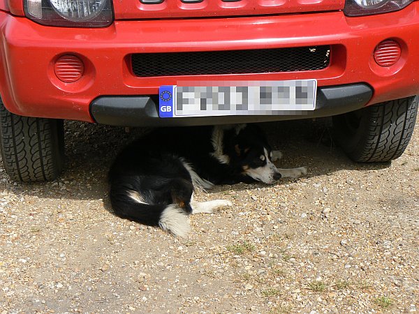
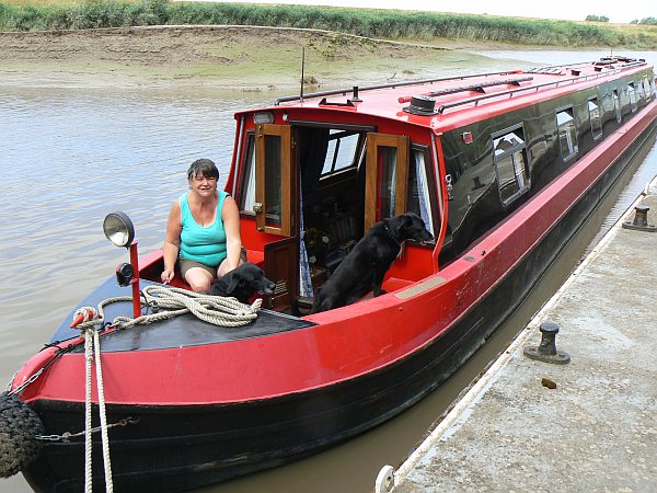
After a few words we carried on to Salters Lode where we were greeted enthusiastically by Barney the dog, a collie / Jack Russell cross who was the result of Basil having leapt over the fence to visit the house next door. On our previous visit in 2004 Basil had been top dog, and we were delighted to meet him again as we had heard elsewhere that he may have died; he is now 15 years old, fairly deaf and nearly blind, but he is happy and healthy in his well-earned retirement. The promontory of mud where he used to sit and greet the boats as they came in from the tideway will forever be known in his honour as "Basil's Point", but his son Barney seemed to be everywhere at once as he rushed back and forth in his determination to miss absolutely nothing .
 |
 |
 |
 |
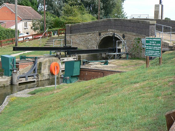
Salters Lode in 2010, now fully mechanised |
Salters Lode in 2004 |
Basil the dog enjoys his retiremen |
Basil's son and replacement, Barney |
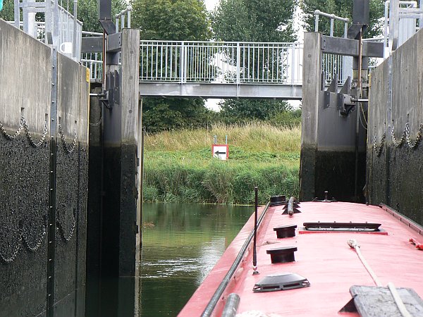
Salters Lode lock has been further improved since our last visit. In 2004 it had only recently had its extended gates added, so that they had to be winched open and shut with wires that the lock-keeper clipped on to the ends of the gates themselves, using 12-volt winches on the bank that were powered from a car battery that the lock-keeper carried around the lock. Now it has all been fully automated so that he only has to press a button on the console. The approach channel has also been dredged, so that it was possible for us to leave the lock just before low tide. The turn up-river against wind and tide was very difficult, as the channel was barely wide enough for us to get around, but soon we were making our way towards Denver against the last of the ebbing tide.
When we arrived at Denver we were pleased to find that we could approach the pontoon to our left directly because, unlike the previous occasion, the channel had been properly dredged; in 2004 we had had to manoeuvre round to the right of the island of mud first. Even so, at low tide we were sliding over the mud until we came to rest a couple of feet outside the pontoon with half the propeller out of the water.
 |
 |
 |
 |
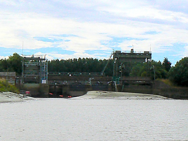
Heading up to Denver at low tide |
This enlargement from the previous picture shows the approach to Denver Sluice (on the left) |
It was only just deep enough for us to get to Denver |
Map of the Denver Relief Channel |
The tide soon turned and we were joined by another boat for the small rise through Denver Sluice, and then we tried unsuccessfully to stop for a drink at the Jermyn Arms whose good beer we remembered fondly from our previous visit. The pub no longer allows boats to use their ample moorings, in case (the landlady told me) someone were to get drunk, fall off their boat, and sue the pub. The nearby EA moorings were out of action because they had subsided, and when I asked the pub landlady if she knew of anywhere that we could moor in order to visit the pub, she made it very obvious that as I was a boater she really didn't want my custom!
 |
 |
 |
 |
Locking down to the Relief Channel, which is way below sea level. |
On the relief Channel, approaching Downham Market bridge. |
The limit of navigation is clearly marked here. |
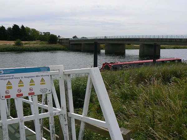
The mooring at Wigginhall St Mary Magdalene |
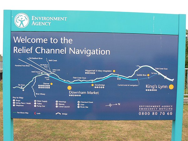
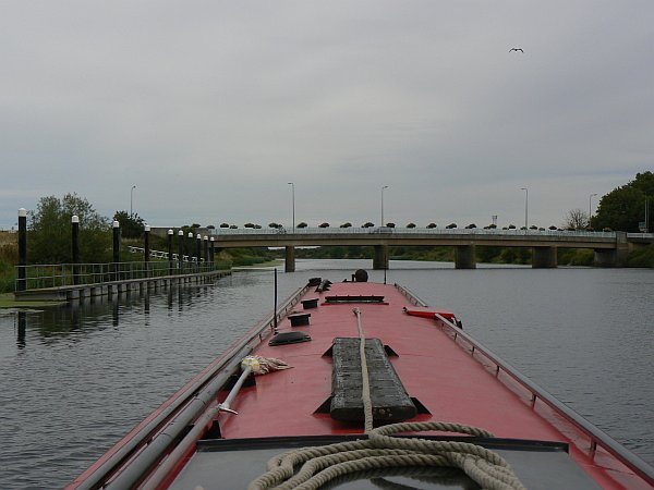
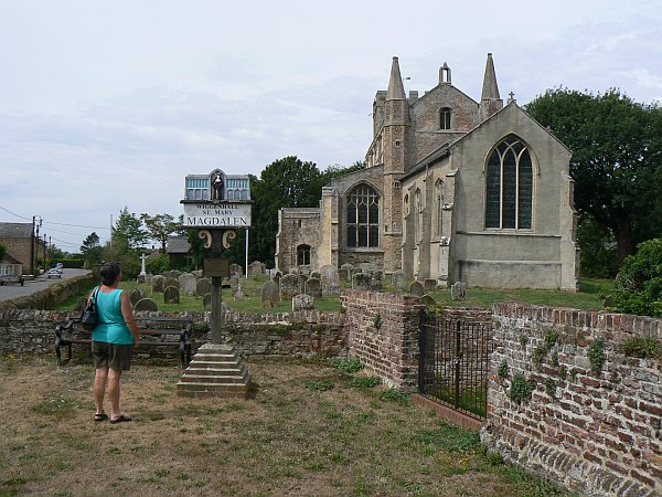
We now had an opportunity to visit a stretch of water that was new to us, and which was not shown on our maps, the Denver Relief Channel. During the winter and at other times of heavy rainfall this 200-foot wide channel serves to divert water from the south and east directly to Kings Lynn without adding it to the already-full Great Ouse, but at times of low water it is navigable via Downham Market to within a couple of miles of Kings Lynn. So the next morning we locked down to the Channel and made our way to the limit of navigation which is marked by an unusual but unambiguous sign, before turning back to the delightfully-named village of Wigginhall St Mary Magdalene. There is a mooring pontoon there, so we walked into the village and visited the church and the pub. The village would be having a scarecrow event shortly so there were scarecrows in some very odd places, including one who appeared to be about to jump off the church tower.
 |
 |
 |
 |
Debbie admires the village sign outside the church |
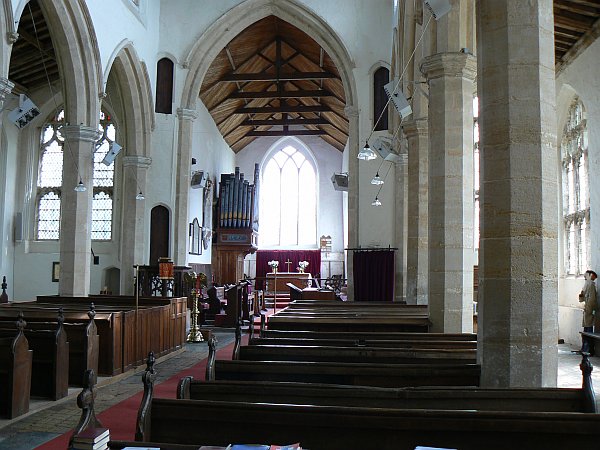
The beautiful interior of the church |
Bats must, of course, take priority over humans |
The outside of the church - spot the scarecrow on top of the tower |
The village and the church delighted us, but the pub was a disappointment. It was very pretty on the outside, but the inside looked as if it had been decorated in the style of a cheap club in the 1970s, and had not been touched since. A large screen showing MTV filled one wall, there were no other customers, and when we asked about beer we were offered only a variety of lagers. There was one real ale pump, so we requested a pint each, but after delivering just one pint it stopped working and could not be coaxed back into life even when the barrel was changed. We shared the indifferent pint and left hurriedly.
 |
 |
 |
 |
A pretty doorway in Downham Market. |
The clock tower in Downham Market |
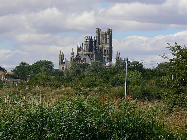
The spectacular Ely Cathedral, known as the "Ship of the Fens" |
The waterfront at Ely is very pretty too |
We returned back along the Relief Channel and stopped at Downham Market. The walk up the hill to the town is well worthwhile as it is a very pretty town with a good range of shops, so we stocked up with supplies and made our way back to the main river above Denver, ready to travel up the river through Ely. The river there is wide, deep, straight, and frankly rather boring, so it was enjoyable to turn right at Popes Corner to join the Old West River - although it was a disappointment to see that there was absolutely no trace of the "Fish and Duck" pub there, for we had enjoyed visiting this unique establishment in 2004.
 |
 |
 |
 |
I thought this sign on a bridge was rather insensitive - what about water transport? |
But this large steel sculpture nearby made me smile. |
The 'Fish and Duck' in 2004 |
The same site of the 'Fish and Duck' in 2010 (from the other direction) |
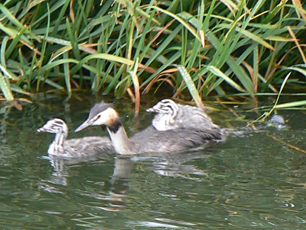
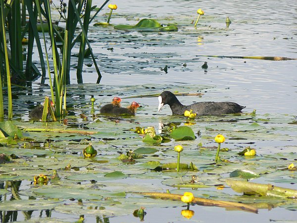
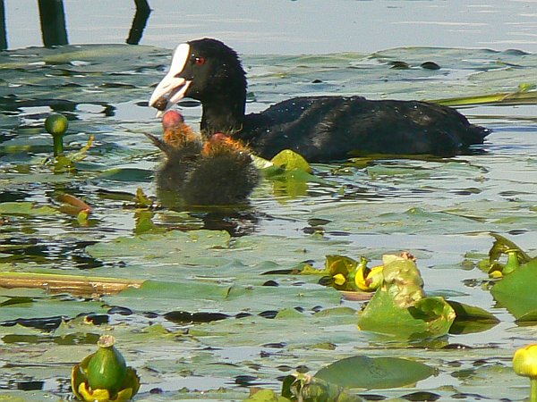
Moving on to smaller rivers now meant that there was more wildlife to see, including several late (or second) broods.
 |
 |
 |
Baby grebes hitch a ride on Mum's back whenever they can |
Baby coots hope that Mum will bring them some food ... |
... which of course she does |
The Old West River is quite pretty and very remote, but there is a real shortage of places where you can moor overnight. We however were now set to make our way up to Bedford ...
All pictures on this site are © Allan Jones unless otherwise stated
![]()