
| Go to Allan's Page | Back to Boston | Canals Home Page | Go to Deb's Page |
For reference, the local branch of the IWA published an excellent map of the Drains in 2011. They had not been so well mapped in 2006.
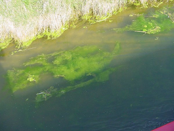
The river Kyme, or Kyme Eau, was originally navigable via the Sleaford Navigation up to Sleaford, but this is awaiting restoration. Being privately owned, the navigation of the Kyme is also a matter of chance, and is generally possible only for a few weeks in April or May, when the water level is right and the weed hasn't yet had time to grow. Some years it is navigable for longer than this; others it is never navigable by powered craft at all. The weed is like a thick blanket of candyfloss, filling the water and making navigation impossible in two distinct ways. Firstly, it forms one continuous mass that is almost impossible to push through, and secondly it collects around your propellor in an ever-growing ball so that it has no propulsive effect and becomes impossible to turn. You cannot simply pull it off the propellor, you would just keep pulling forever; you have to cut it away first, and then bow-haul the boat into clear water.
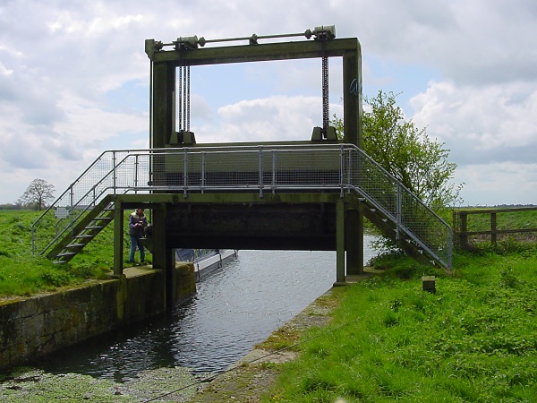
Luckily we arrived there at the end of April; the water levels were about right (although a bit low above the lock) and the weed had only just started to grow. There was just one potential problem, it had been reported to us that the bottom gates of the first lock (South Kyme Lock, about a mile upriver) wouldn't close properly. We investigated the night before, to find that the offending obstruction had been removed so the gates now shut properly; but unfortunately that obstruction had been the gate paddle so it was a bit more difficult to fill the lock (although as it was a guillotine gate at the top, it was simply a matter of raising it a bit further than usual, and then making sure you closed it behind you when you left; instructions to this effect had been posted at the lock so we knew it must be navigable).
The next morning we passed through the single pair of gates (or pointing doors as they are called around there; the water closes them automatically if the level of the Witham rises above that of the Kyme) and travelled up to the lock with the two boats. We had already decided not to take Keeping Up beyond the lock, for although there is a winding point below the next lock (Cobblers lock) it was highly doubtful that we could get that far or that we would be able to wind even if we did - a view confirmed by an exhausted couple that we met who had just spent several hours bowhauling their narrowboat backwards for a couple of miles. Instead we winded below South Kyme lock and left Keeping Up there while we proceeded upriver with Malcolm on Wud-E-Nuff.
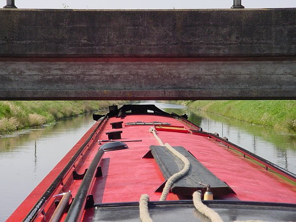
The disadvantage of having to close the guillotine after leaving the lock was instantly apparent; it takes 600 turns of the wheel to raise or lower the gate, so passage up and back would take 2400 rotations. I'll never complain about the Nene guillotines again (maybe). Also there's no lock-landing above the lock, so on a windy day (as it was) it's quite difficult to stop and then get going again.
|
|
|
|
|
|
|
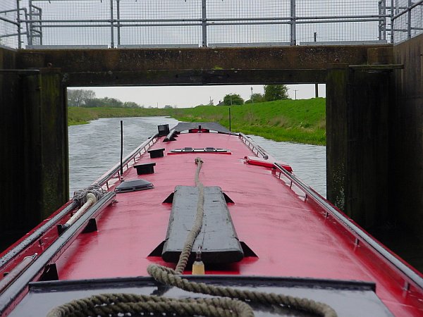
Approaching the pointing doors ... |
... and through them to Kyme Eau |
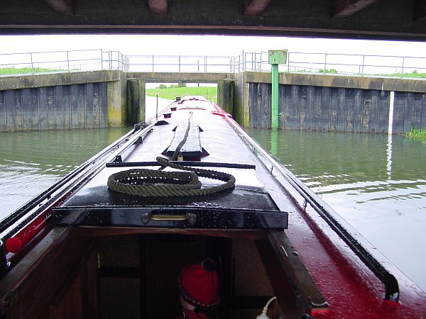
South Kyme lock. It takes 600 turns to raise the guillotine |
Wud-E-Nuff in South Kyme Lock. Keeping Up has been turned and moored below. |
Approaching South Kyme village |
This low bridge had prevented Wud-E-Nuff from reaching South Kyme before |
As you approach South Kyme village you meet a road bridge whose height is indicated by a hanging metal bar just beforehand. Wud-E-Nuff had been unable to pass under this bar before, but the river level was several inches down and we cleared it with 3 inches to spare. We then measured almost 6 inches of clearance under the bridge, showing that the bar was distinctly pessimistic (why do they always do that); as the bar is hung from chains, this now established for the future that if Wud-E-Nuff could pass under without lifting the bar by no more than a couple of inches, then it would pass under the bridge too.
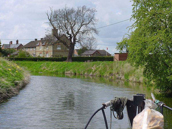
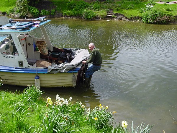
The village of South Kyme is incredibly pretty, and well worth the trip. We made it under all the bridges, for about half a mile beyond the village, before having to give up as we were grounding continually and also starting to meet the dreaded weed. On the way back we stopped in the village so that Malcolm could climb down a ladder on the transom and clear the propellor. After passing back through the lock we collected Keeping Up again and headed back through the pointing doors on to the Witham.
 |
 |
 |
 |
 |
 |
South Kyme village is very pretty |
Beyond South Kyme it got too shallow to go any further |
Malcolm clears the weed off the prop |
Frith Bank Drain |
Plenty of clearance under the bridge at the East end of Frith Bank Drain |
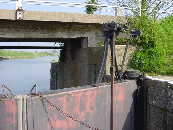
Cowbridge lock. No balance beams, you just heave on the chains |
Now it was time to explore the Witham Navigable Drains (WNDs). We had planned to spend two days, more-or-less retracing the route taken by the Tuesday Night Club in 2005 but the BW sluice-keeper warned us that the weather forecast was for 2" of rain the following night, so we should restrict our visit to just one day. He gave us a great deal of information about navigating the Drains but most of it was second-hand information and was either wrong or out of date. Future navigators should note in particular:
- From the crossroads of Newham Drain and West Fen Drain, there is NOT a low bridge on the West Fen Drain but there IS a very low bridge to the north on Newham Drain (see photo)
- After passing the Maud Foster Windmill, there is NOT a weir across the drain just below the surface, and navigation through the bridge to the wider stretch beyond is perfectly possible (the EA have confirmed this!)
- There is NOT enough room to wind a full-length boat next to Maud Foster Windmill. You need to go through the bridge, where there is plenty of room, or you must reverse back to the previous bridge as we did (because we had been told it was impossible to go any further)
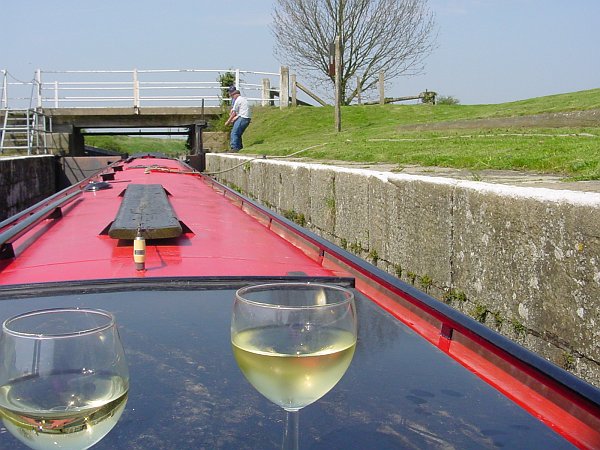
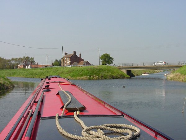
After a night at Anton's Gowt we were again joined by Malcolm (by car this time). The lock at Anton's Gowt is very hard work, as the gates are simply enormous to keep floodwaters out and are therefore extremely heavy. It is also a very long way down to the boat, and when you exit the lock there is no lock landing - just a long steep rickety ladder in the wall below the gate. We turned right but, before setting off, we reversed back through the bridge on Newham Drain (the way we hoped to come back) to measure the amount of clearance over our roof. We need about 5'10" of air draught, and there was a good 8" of clearance under the bridge which put it at a comfortable 6'6". We set of happily along the Frith Bank Drain which was quite deep and surprisingly pretty, and soon reached the bridge at the other end. With plenty of headroom here we turned right and entered Cowbridge Lock. Although our map showed this as only 60 ft long, it is actually at least 70 ft long (but an unusual width of about 10 ft). It was unusual in having no balance beams on the bottom gates, which have to be pulled open and shut by using a couple of chains that are attached to their far ends. The top is another guillotine, but this one has not too many turns and is very free-running. If only they could all be like that!
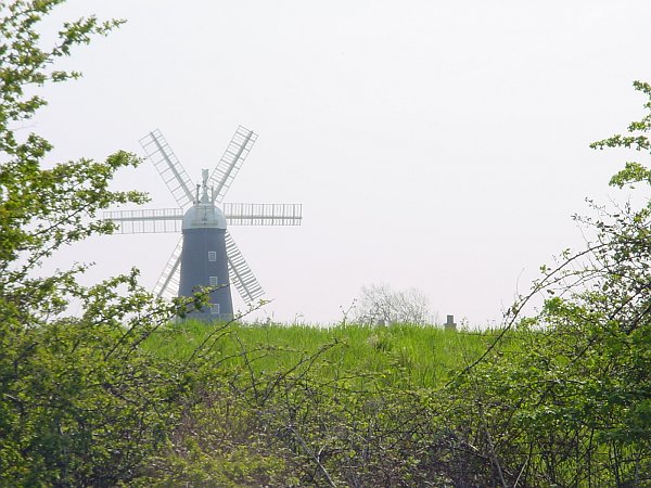
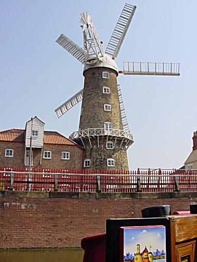
After Cowbridge Lock we turned sharp left up Stonebridge Drain, which is wide and deep, and has piled edges (looking like corrugated asbestos). We found that you can see over the banks if you stand on the roof, or you can stop almost anywhere and scramble up the bank for a look around. The few people we met were very surprised to see a big narrowboat on their Drain. The bridge at Sibsey was quite low, with only about 2" of clearance, and we made good progress past the 6-sailed windmill (known as Trader Mill - the drain is sometimes named Trader Drain after it) as far as the junction with the East Fen Catchwater where we winded (we could have gone further but there is no other winding point).
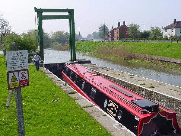
We returned, in blazing sunshine, past Cowbridge (ignoring the tempting-looking pub there) and carried on into Boston. It felt like slipping in through Boston's back door, and suddenly we had reached the Maud Foster windmill that we had explored on foot a couple of days before. Our map showed moorings here, but they collapsed a couple of years ago and there is now nowhere to stop. After an unsuccessful attempt at winding in the 60-foot gap between the brick walls, we reversed back to the previous bridge and winded without difficulty.
 |
 |
 |
 |
 |
 |
In Cowbridge Lock |
Stonebridge Drain near Sibsey - Trader Windmill |
Winding at the junction of Stonebridge Drain and East Fen Catchwater |
Failing to wind by the Windmill on the Maud Foster Drain |
Going back down Cowbridge Lock |
Frithville (junction of West Fen Drain and Medlam Drain) |
 |
 |
 |
 |
 |
 |
Road signs can tell you where you are and which way to go |
Low Bridges on West Fen Drain |
Lack of clearance shows the waters are rising ... |
... so we didn't go north up Newham Drain |
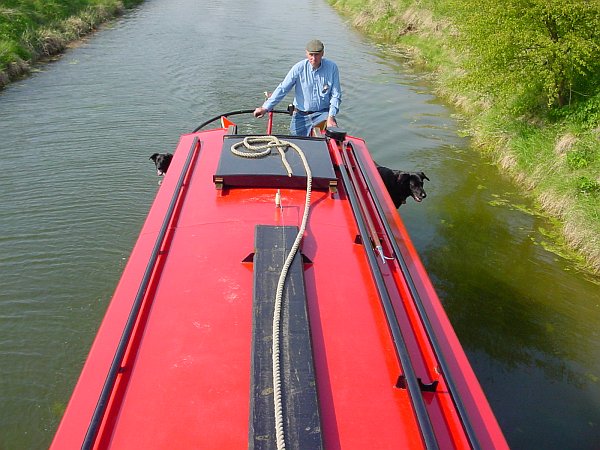
Heading South on Newham Drain. Note port and stbd lookout dogs |
The weed is visibly growing in the sunshine. It wraps around your prop like candy-floss. |
After a couple of glasses of wine to celebrate our successful entry to Boston via the Drains, we went back down Cowbridge Lock and set off up the wide, straight West Fen Drain. At the next junction, at Frithville, the Medlam Drain continues straight on and the West Fen Drain turns left, becoming much smaller as it does so. We climbed up the banks to look at the road signs and check our bearings before continuing along that Drain, noting as we did so that the bank-side gauges showed a 4" increase in water level since we came through Anton's Gowt. We hurried along, since if it increased by the same amount again during the afternoon, we would be unable to get back under the Meer Booth road bridge.
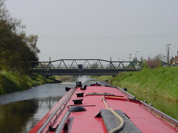
Sure enough there was much less clearance under the bridges now, and we were moving much more slowly as the drain was narrow and weedy. At the junction with Newham Drain we would have liked to explore further but the rising waters ruled out that option, so we just poled around the sharp left-hand turn into the southbound Newham Drain. This was very narrow, and quite weedy in places, but we made our way steadily back to Anton's Gowt and slipped under the bridge with a couple of inches to spare before coming back up the lock. We moored for the night again on the low grass bank just beyond the too-high signposted moorings, and completed an excellent day down the Drain with an enormous meal in the Malcolm Arms pub.
| Go to Allan's Page | Back to Boston | Canals Home Page | Go to Deb's Page |
All pictures on this site are © Allan Jones unless otherwise stated
![]()